


Real trails. Great adventures.
TrailRunner Mini is built for runners, hikers, cyclists and mountain bikers who want to discover ways beyond the main routes.
TrailRunner Mini is the best route planning app for Apple MacBook, iMac, iPad and iPhone.
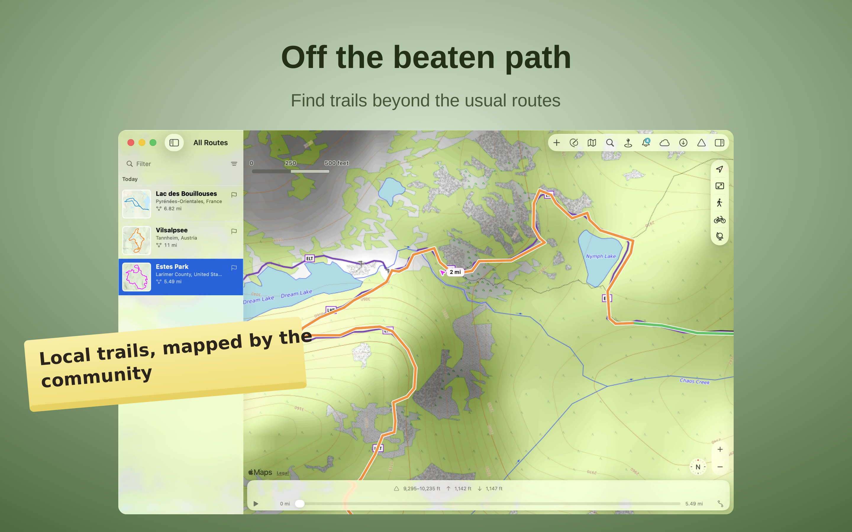
Off the beaten path
TrailRunner Mini plans routes on OpenStreetMap — a map cared for by people who know their region. Discover marked hiking trails, singletrack and nature paths away from the main routes. Hillshade and contour lines show the terrain and make it easier to find your way.
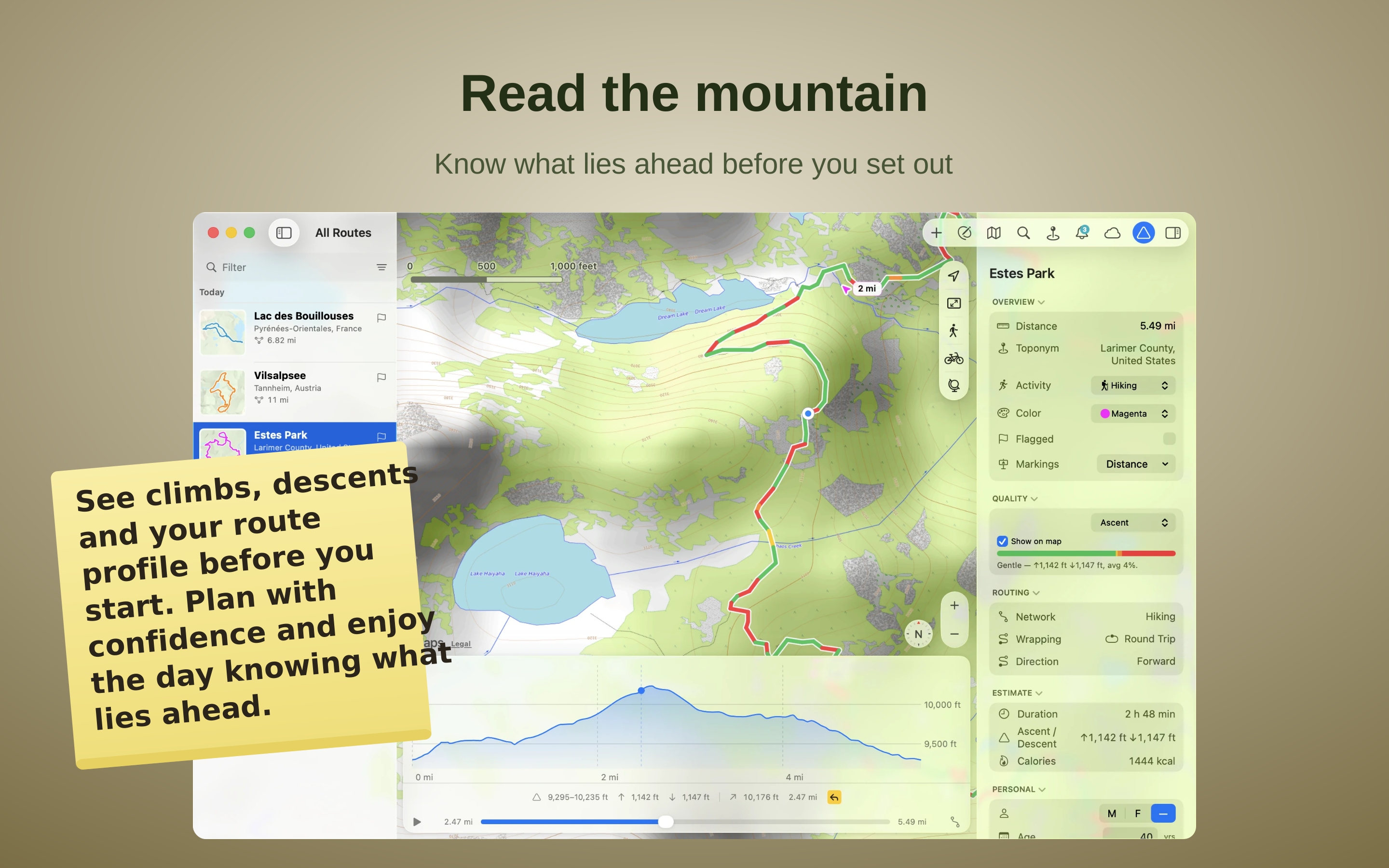
Read the mountain
Read the mountain before you set out — and plan ahead. Every route comes with a full elevation profile: climb and descent in metres, the highest and lowest points, and how steep each stretch runs. As you build a route the climb adds up live, and a bar shows how much is flat, rolling or steep — so you shape exactly the effort you want, and scrub along the profile to see where it rises and falls.
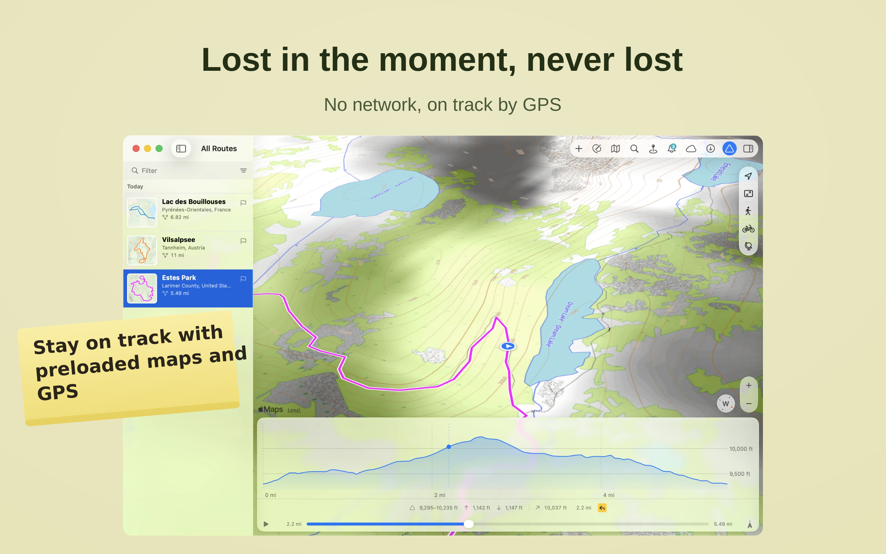
Lost in the moment, never lost
Download a region in advance — the map and navigation keep working even when there's no more mobile signal and only GPS still knows where you are.
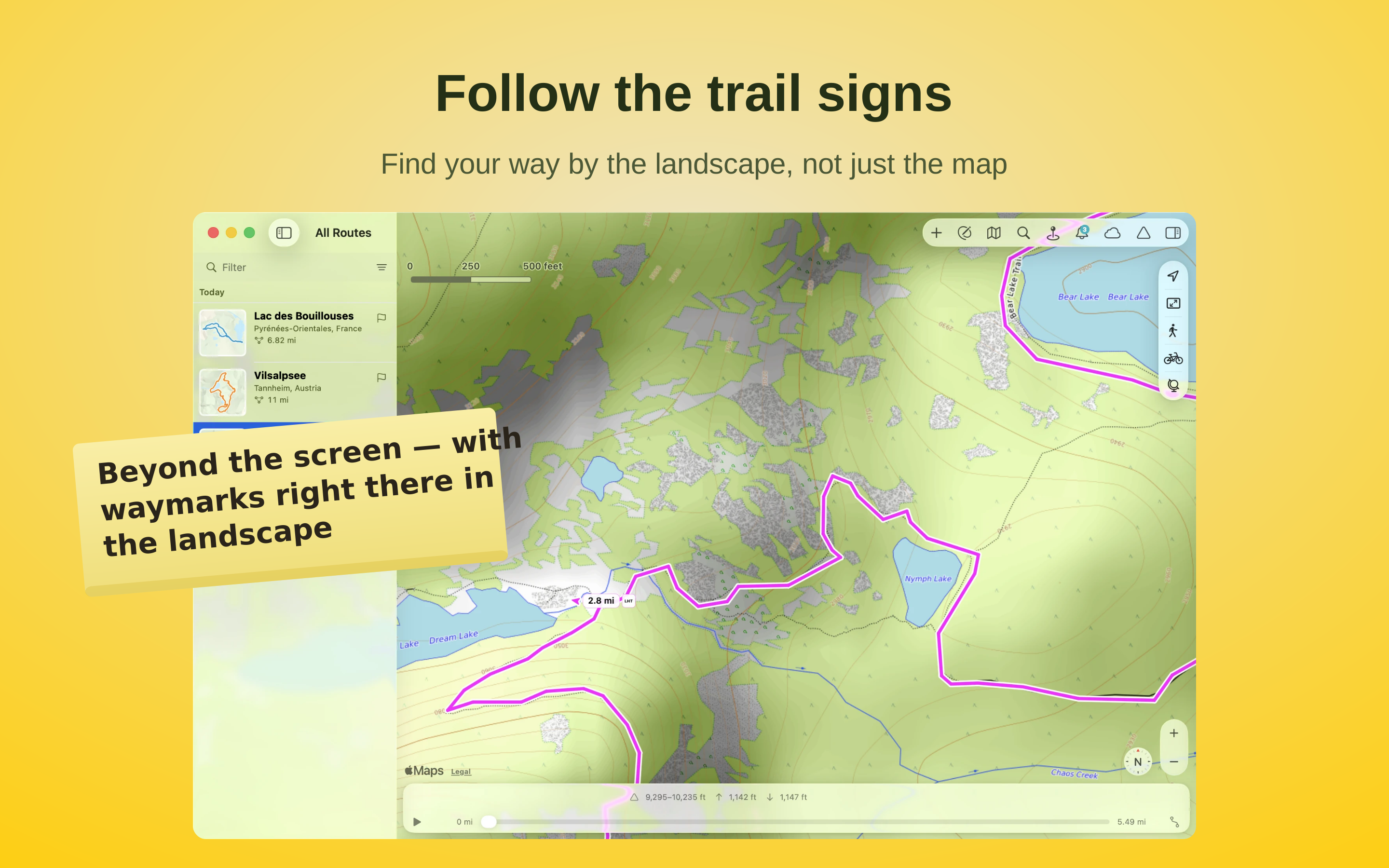
Follow the trail signs
Follow the official waymarks with their distinctive colours and symbols. Where they're recorded in the official trail network, TrailRunner Mini shows the same markings you see out on the trail. So at every junction you can tell at a glance whether to keep following the marked trail or turn onto another path.
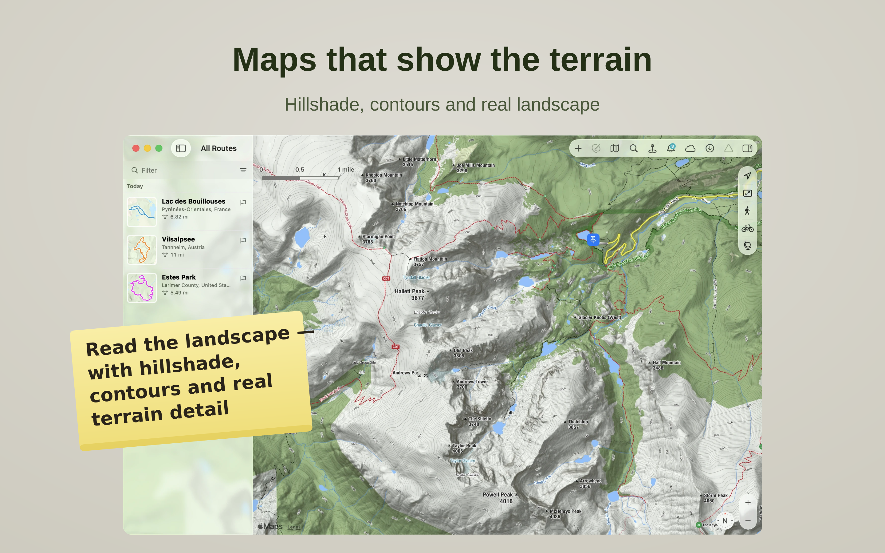
Maps that show the terrain
See the shape of the land, not just the lines on it. TrailRunner Mini draws topographic maps with hillshade and contour lines that bring out ridges, valleys and summits at a glance, and lets you switch between beautiful regional map styles. Read the terrain around your route and choose the paths that suit it.
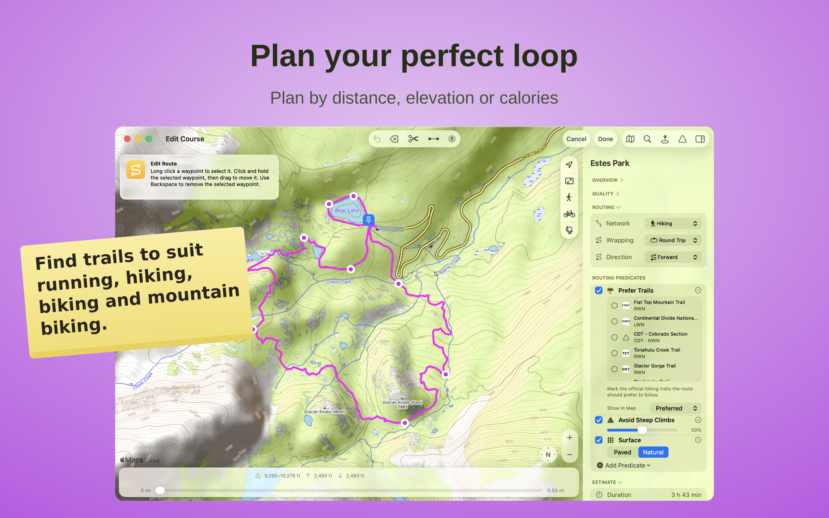
Plan your perfect loop
Build routes to your goals — distance, climb or calories — on ways suited to running, hiking, biking and mountain biking. Read the mountain before you go: see climbs, descents and the course of your route before you start, and enjoy the day knowing what lies ahead.

Your tour, on every device
Import GPX, KML or Garmin TCX/FIT files and turn them into your own tour. Edit them, trim them or bring them back onto real trails without losing the original course. Your routes, collections and landmarks stay in sync across Mac, iPad and iPhone.
What people say
Practical, intuitive and reliable.
The app did hang a couple of times when I tried to import a large number (200-300) of my past exported runs. I did import them successfuly by reducing the number of imports at one time.
I wanted an app that allowed me to export all my run data and Trailrunner mini does this—a hard requirement for me. I refuse to use other apps that lock your data in and prevent you from exporting it. I've been bitten too many times when many apps eventually stop being supported and you lose your data.
The subscription cost is well worth having a good app. Developers need to support themselves too, I don't understand how others can complain that developers should give away their hardwork for free. :–((
have the money for that.
Vraiment bon.....incroyablement bien fait et facile d'utilisation merci
But it's one flaw is that the route must go along a known road or major path. Which would be really annoying for runners and mountain bikers who make their own paths.
The tracks can be exported to .gpx or .kml. GPX files will load into apps such as mobileX (Open Street Map) )or Ordnance Survey (UK mapping) on; KML files will open in Google Earth to enable a fly-over of the route. By adjusting the settings in Earth you can really get a feel of the route planned.
The app has improved during the years I’ve been using it. It has easily repaid my investment by giving so much enjoyment.
I occasionally have a problem when I click on a file to open it in the App. Not a big problem but means I give 4* rather than 5*.
Thank you Berbie for an app that really enhances my enjoyment of walking. This year we are in Ireland for our holiday and your app has been a great help.
Loads of fun to map out new routes.
One glitch! it happens on both my computers, The program crashes every now and then, I’m sure the team are on that!
However, once fixed, I must say this is the best mapping app I have used - and once it failed and I spent an afternoon trying to find another equivalent app, I realized how much I liked TRM. Simple way to trace and create maps - it is a bit bulky in how it loads map data at smaller scales, but works extremely well. Unless I'm missing a few apps, I have tried as many of the affordable ones I could, including the giant's online free sources, and find this to be the best. Company service was quick and prompt, although it seems to be a fairly small operation, Berbie seemed concerned to get it right as soon as he could.
Now let's hope the update comes soon. 5 starts once that is dealt with.
The reason I have given it four stars instead of five is the syncing with RaceBunny for the iPhone. I have had the odd little issue with this but there is help on the internet at the developer's website and if you search Google. One thing to note on the syncing, it is working perfectly for me right now and has been for a while.
Overall, very happy with the price for the app. Keep up the good work Berbie Software.
Display of data is clear, and motivational and once you master transferring gpx files(not difficult) it is very straightforwardto operate.
The application itself is simple and effective. It is quite easy to integrate it with RaceBunny on iPhone (you only need to have dropbox). I am looking forward to test it on the South Downs Way.