

Senderos reales, gran aventura
TrailRunner Mini está diseñado para corredores, senderistas, ciclistas y ciclistas de montaña que quieren descubrir senderos más allá de las rutas principales.
TrailRunner Mini es la mejor app de planificación de rutas para Apple MacBook, iMac, iPad e iPhone.
Fuera de los senderos trillados
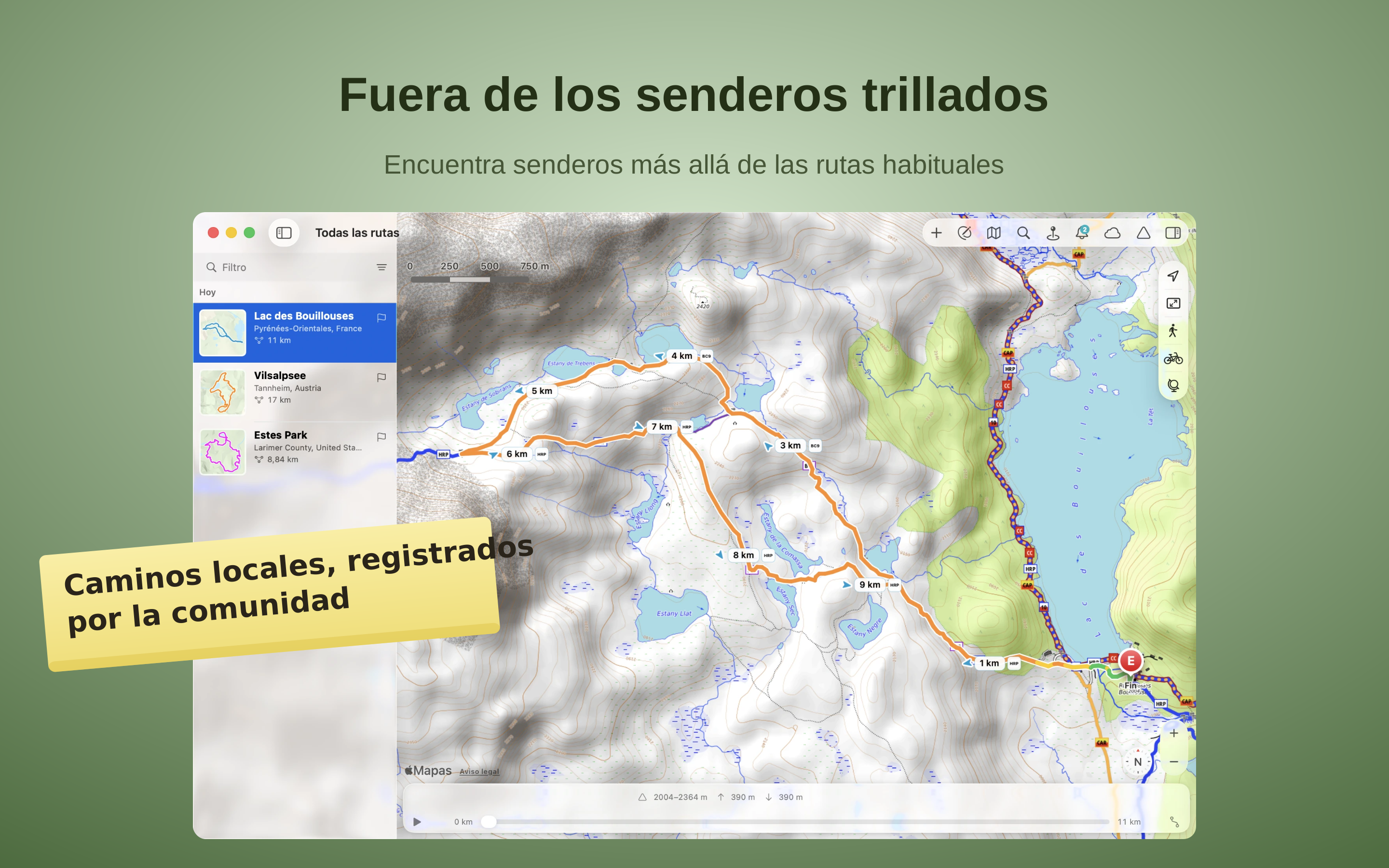
TrailRunner Mini planifica rutas con OpenStreetMap, un mapa cuidado por personas que conocen su región. Descubre senderos señalizados, singletracks y caminos naturales lejos de las rutas principales. El sombreado del relieve y las curvas de nivel muestran el terreno y facilitan la orientación.
Lee la montaña
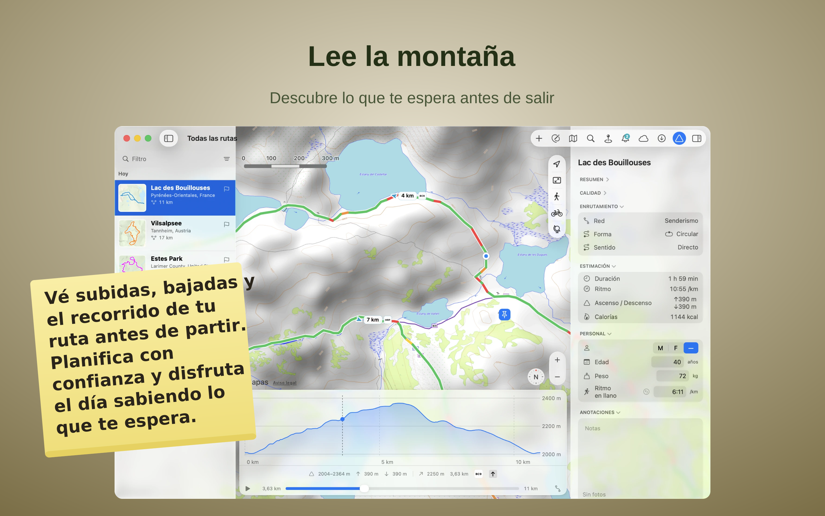
Lee la montaña antes de salir — y planifica con antelación. Cada ruta incluye un perfil de altitud completo: subida y bajada en metros, el punto más alto y más bajo y lo empinada que es cada sección. Mientras creas una ruta, el desnivel se suma en directo y una barra muestra cuánto es llano, ondulado o empinado — así das forma justo al esfuerzo que quieres y recorres el perfil para ver dónde sube y dónde baja.
Inmerso en el momento, nunca perdido
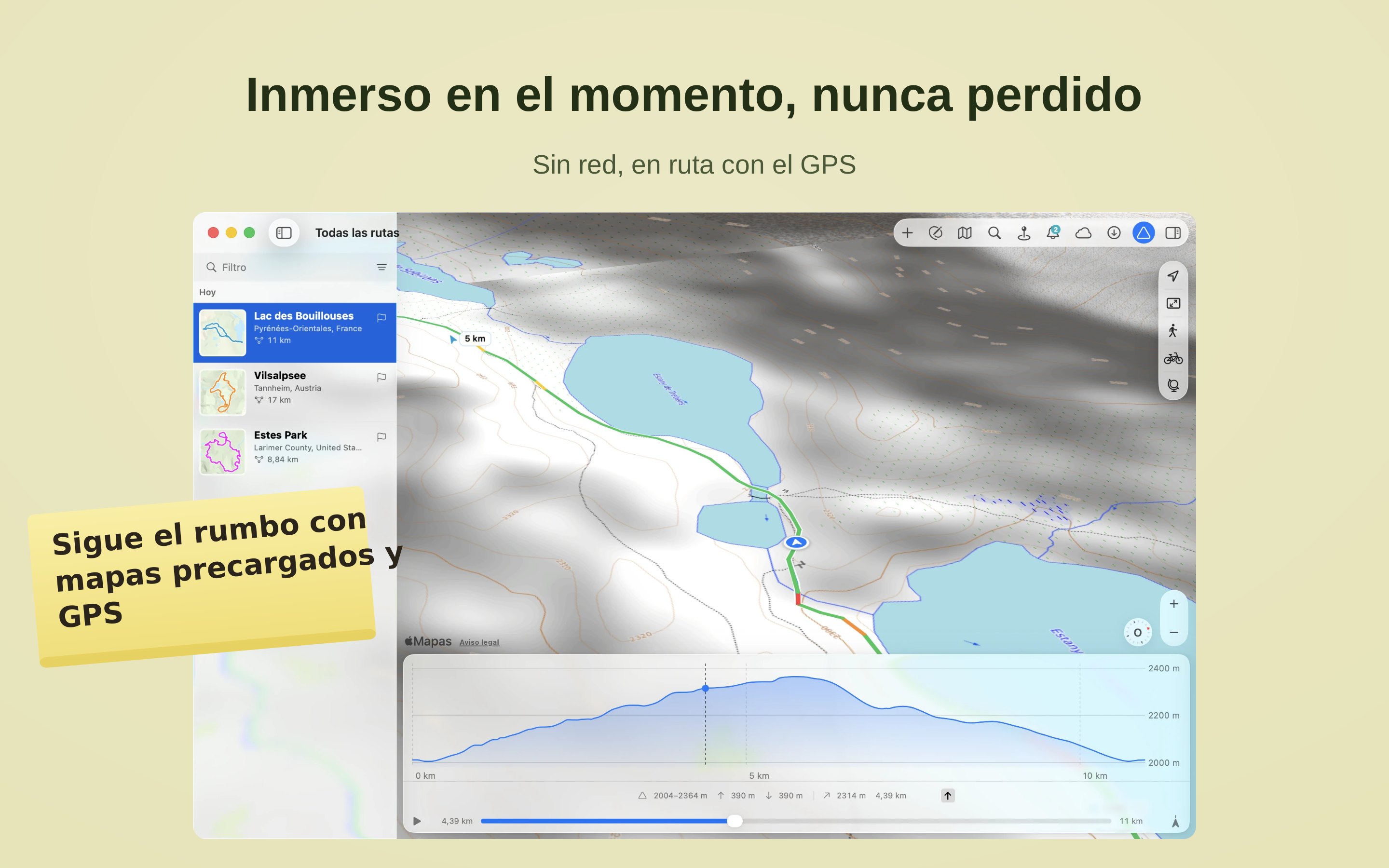
Descarga una región con antelación: el mapa y la orientación siguen funcionando aunque ya no haya cobertura móvil y solo el GPS conozca tu ubicación.
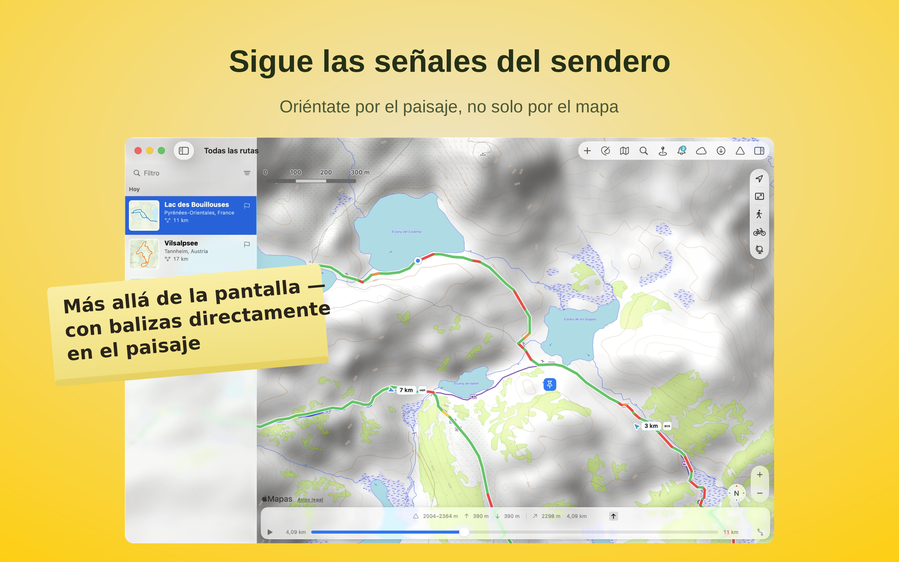
Sigue las señales del sendero
Sigue las balizas oficiales con sus colores y símbolos inconfundibles. Donde están registradas en la red oficial de senderos, TrailRunner Mini muestra las mismas marcas que ves fuera en el camino. Así, en cada cruce reconoces al instante si sigues por el sendero señalizado o si debes desviarte hacia otro.
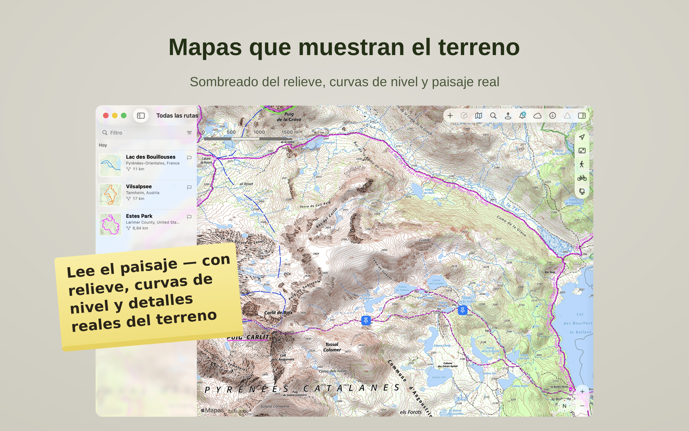
Mapas que muestran el terreno
Ve la forma del terreno, no solo las líneas del mapa. TrailRunner Mini muestra mapas topográficos con sombreado del relieve y curvas de nivel que resaltan crestas, valles y cumbres de un vistazo, y te permite cambiar entre bonitos estilos de mapa regionales. Lee el terreno alrededor de tu ruta y elige los caminos que mejor le van.
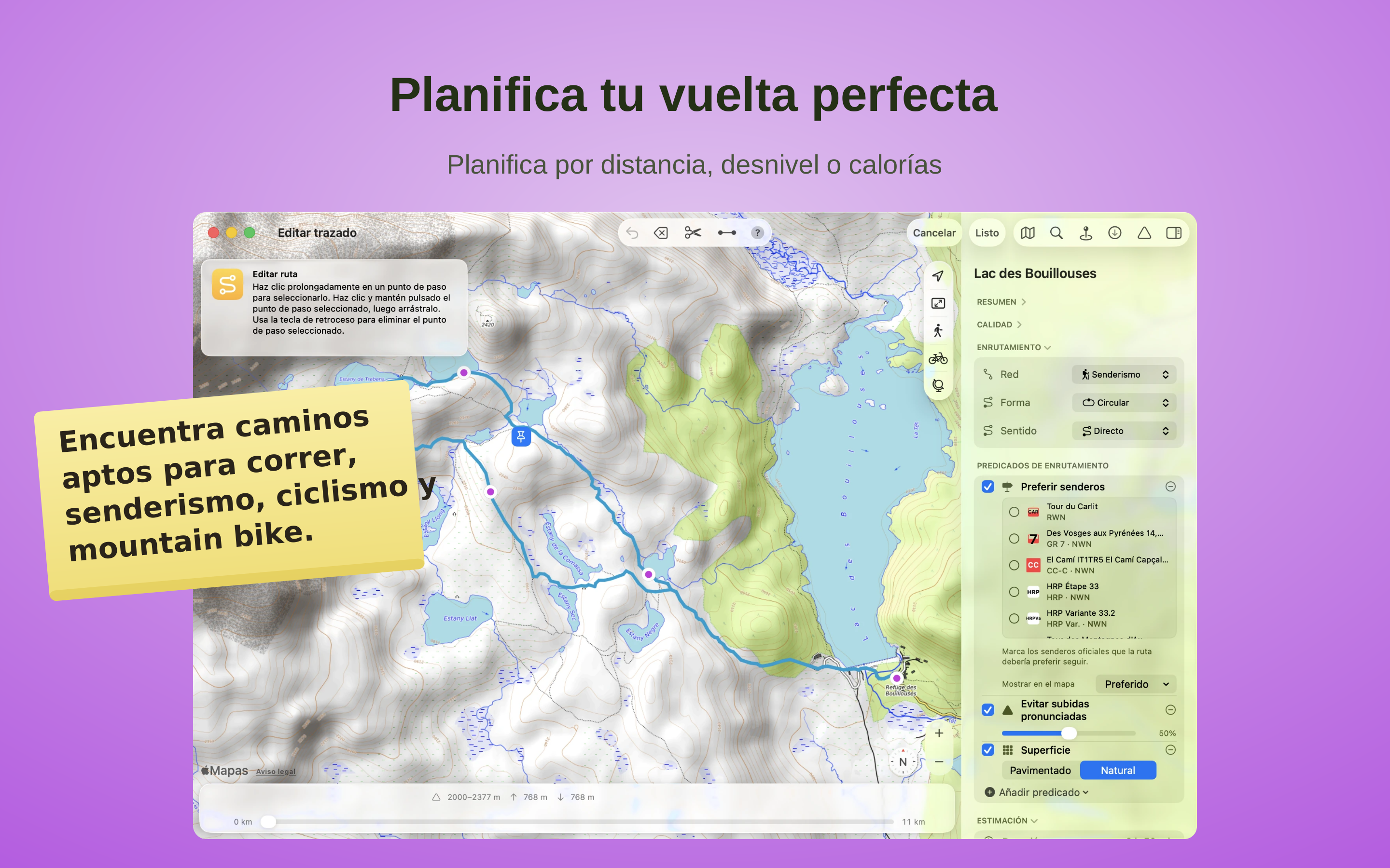
Planifica tu vuelta perfecta
Crea rutas según tus objetivos: distancia, desnivel o calorías, utilizando senderos adecuados para correr, senderismo, ciclismo y ciclismo de montaña. Conoce la montaña antes de salir: consulta ascensos, descensos y el recorrido de tu ruta antes de empezar y disfruta del día sabiendo lo que te espera.

Tus aventuras, en todos tus dispositivos
Importa archivos GPX, KML o Garmin TCX/FIT y conviértelos en tu propia ruta. Edítalos, recórtalos o llévalos de vuelta a caminos reales sin perder el trazado original. Tus rutas, colecciones y puntos de referencia se mantienen sincronizados entre Mac, iPad y iPhone.
Lo que dicen los usuarios
La interfaz ya está totalmente en español, lo cual se agradece muchísimo. Si ya añadieran la sección de ayuda y documentación en español, sería una app de 10 absoluto. ¡Muy recomendable!
Practical, intuitive and reliable.
The app did hang a couple of times when I tried to import a large number (200-300) of my past exported runs. I did import them successfuly by reducing the number of imports at one time.
I wanted an app that allowed me to export all my run data and Trailrunner mini does this—a hard requirement for me. I refuse to use other apps that lock your data in and prevent you from exporting it. I've been bitten too many times when many apps eventually stop being supported and you lose your data.
The subscription cost is well worth having a good app. Developers need to support themselves too, I don't understand how others can complain that developers should give away their hardwork for free. :–((
have the money for that.
Vraiment bon.....incroyablement bien fait et facile d'utilisation merci
But it's one flaw is that the route must go along a known road or major path. Which would be really annoying for runners and mountain bikers who make their own paths.
The tracks can be exported to .gpx or .kml. GPX files will load into apps such as mobileX (Open Street Map) )or Ordnance Survey (UK mapping) on; KML files will open in Google Earth to enable a fly-over of the route. By adjusting the settings in Earth you can really get a feel of the route planned.
The app has improved during the years I’ve been using it. It has easily repaid my investment by giving so much enjoyment.
I occasionally have a problem when I click on a file to open it in the App. Not a big problem but means I give 4* rather than 5*.
Thank you Berbie for an app that really enhances my enjoyment of walking. This year we are in Ireland for our holiday and your app has been a great help.
Loads of fun to map out new routes.
One glitch! it happens on both my computers, The program crashes every now and then, I’m sure the team are on that!
However, once fixed, I must say this is the best mapping app I have used - and once it failed and I spent an afternoon trying to find another equivalent app, I realized how much I liked TRM. Simple way to trace and create maps - it is a bit bulky in how it loads map data at smaller scales, but works extremely well. Unless I'm missing a few apps, I have tried as many of the affordable ones I could, including the giant's online free sources, and find this to be the best. Company service was quick and prompt, although it seems to be a fairly small operation, Berbie seemed concerned to get it right as soon as he could.
Now let's hope the update comes soon. 5 starts once that is dealt with.
The reason I have given it four stars instead of five is the syncing with RaceBunny for the iPhone. I have had the odd little issue with this but there is help on the internet at the developer's website and if you search Google. One thing to note on the syncing, it is working perfectly for me right now and has been for a while.
Overall, very happy with the price for the app. Keep up the good work Berbie Software.
Display of data is clear, and motivational and once you master transferring gpx files(not difficult) it is very straightforwardto operate.